About My City
(Click to enlarge pictures)
(Most of the content is taken from wiki)
Abbottabad is the principal city of the Abbottabad District in the Northwest Frontier Province of Pakistan. It is located 100 km north of Islamabad at an altitude of 4120 feet (1250 metres) above sea level. The city is located in a valley and is known for it's pleasant weather, educational institutes of high standards and military establishments. It remains a hub of tourism in the summer.
History
Abbottabad was a city of British India, the headquarters of Hazara Division (then a district), andnamed after its founder, Major James Abbott. Abbott settled this district in1853 after the annexation of the Punjab, and became its first Deputy Commissioner. It was an important military cantonment and sanatorium, being the headquarters of a brigade in the second division of the northern army corps. In 1901 the population of the town andcantonment was 7764. Before leaving Abbottabad, Major Abbott wrote a poem titled "Abbottabad".
Demographics
In 1998 the population of Abbottabad District was 881,000. According to the 1998 census, over 70% of population speak Hindko as their first language, Pushto accounted for almost 30% .The national language of Pakistan - Urdu is understood by everyone and English is widely used in business and education. The major tribes of Abbottabad District are Syeds, Jadoons, Pathans, Tanoli, Abbasi, Karlal of which I am a member, Sardar and Rajas.
Education
With its good weather and beautiful landscape, Abbottabad attracts people from all over Pakistan, some for tourism but many by its educational institutions. Abbottabad (sometimes called "The City of Schools") is home to a number of schools, colleges and training institutes. These educational institutions help to promote a high standard of education in the entire region.
The many military training institutes like the PMA Kakul, (Pakistan Military Academy) based in Kakul and the Regimental Training Centres of the Pakistan army give the city a well-organised "military look".
Abbottabad has four Medical Colleges (including a medical college for women) viz Ayub Medical College, Women Medical College, Frontier Medical College and Abbottabad International Medical College. An institute for higher learning for information technology, COMSATS Institute of Information Technology is one of the elite learning Centres for IT in Pakistan.
Other than that, there are many private boarding schools with the exception of Army Burn Hall College which is government owned, that are famous for high standard education. Among these are Army Burn Hall College, Abbottabad Public School, PIPS, Al-Imtiaz Academy and IQRA Academy.Federal governmwnt high schools.The Government postgraduate College offers higher education at Bachelors and Masters degree in literature, natural sciences and exact sciences. The college attracts students from all over the NWFP.
A few Technical Institutions like GPTI Government Polytechnical Institute offer courses for technical & industrial education e.g. DAE (Diploma in Associate Engineering). Quite a few computer institutes are functioning in and around Abbottabad. These institutes are generally affiliated with Board of Technical Education, Peshawar.
Tourism
Tourism is one of the important sources of economic activity in Abbottabad (or the whole mountainous Northern Areas of Pakistan for that matter). In summer when temperatures in the plains of Pakistan rise to well above 45 degrees, large number of tourists come to Abbottabad to shelter from blistering heat and further up towards mountainous north. The Karakoram Highway, which traces one of the paths of the ancient Silk Road, starts from Havelian 15 km south of the Abbottabad town, and passes through the city. The Karakorum Highway is an attraction for the adventure tourists. Abbottabad is the last big town, the first mild-weather tourist city in Northern Pakistan for the tourists coming from the plains in the south.
Places of Tourism
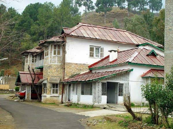
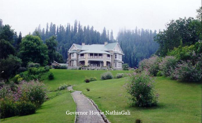
The Karakorams, the Himalayas and the Hindukush mountains can be approached from Abbottabad. Abbottabad continues to be a transit city for tourists, serving as a base for visits to numerous nearby places, such as Hunza, Gilgit, Skardu and Indus Kohistan, of the Karakoram Range. While other hill stations are deserted during the winter Abbottabad has visitors due to its mild winters. A cricket stadium, is located on Murree Road. The Cantonment area of Abbottabad is still very British. The European bungalows, the club, the church and cemetery are still there. Abbottabad is an hour's drive from Nathiagali, the summer capital of the North West Frontier Province.
Ayubia Chair Lifts
Ayubia is 38 km east of Abbottabad. A cluster of four small hill stations of Khanspur, Khairagali, Changlagali and Ghora Dhaka, is called Ayubia and was named after former President Ayub Khan. The complex is spread over an area of 26 KM. The central place has chair lifts.
Dungagali
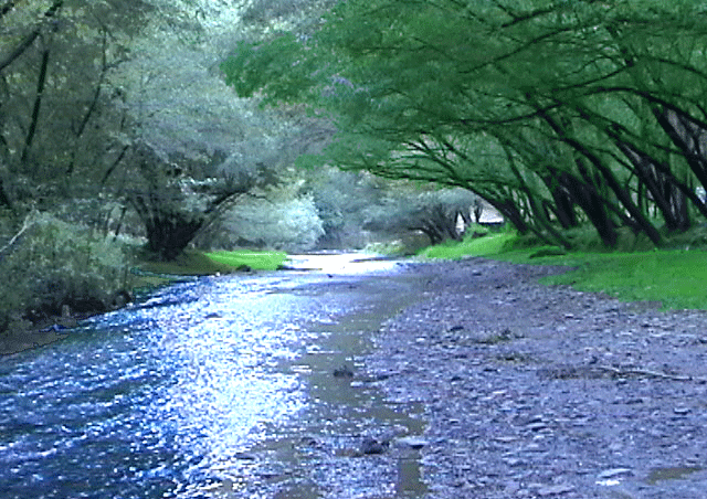
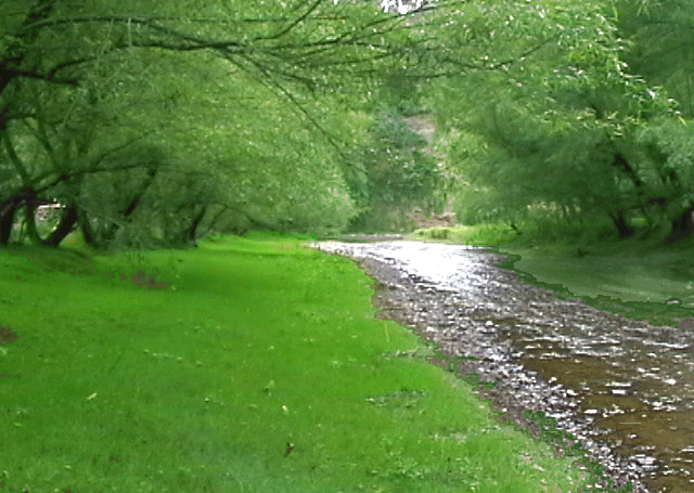
Dungagali is a small resort situated on the slopes of the Mukshpuri hill (2,376 meters.). It commands a view of a series of wooded spurs projecting towards the river Jhelum on the western side. From Dungagali one can climb the 2,813 meters peak of Mukhshpuri, which is the highest point in the range. Natural springs abound on the slopes. It is 34 KM from Abbottabad.
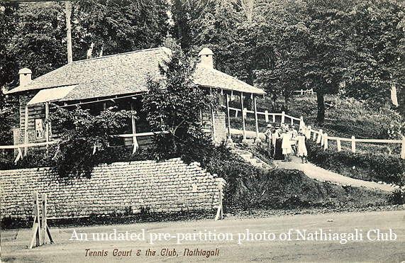
Nathiagali
Nathiagali is clad in pine, walnut, oak and maple trees. It can be approached both from Murree and Abbottabad. It is 32 KM from Abbottabad as well as from Murree. Nathiagali is 2501 meter above sea level and is surrounded by mountains.
Thandiani
Thandiani meaning “cold” in the local language, It is one of the highest places of district Abbottabad at an altitude of 2,700 m. It is 31 KM from Abbottabad City and 25 KM via Thandiani. The drive takes more or less 80 minutes from Abbottabad with lovely views on both sides of the road. The road rises more than 1,219 meters above Abbottabad. The major place on the way is Kalapani at 23 KM from Abbottabad. Hule Ka Danna is about 2 KM North of Thandiani.
Directions